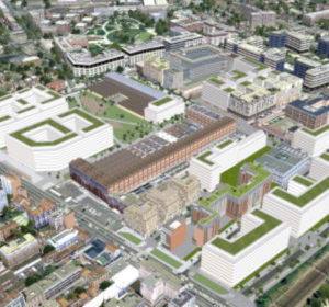
Développer et servir les territoires grâce à leur patrimoine de données numériques
Bionatics développe des solutions digitales innovantes permettant de constituer, utiliser et contribuer au patrimoine numérique de territoires et de leurs projets.
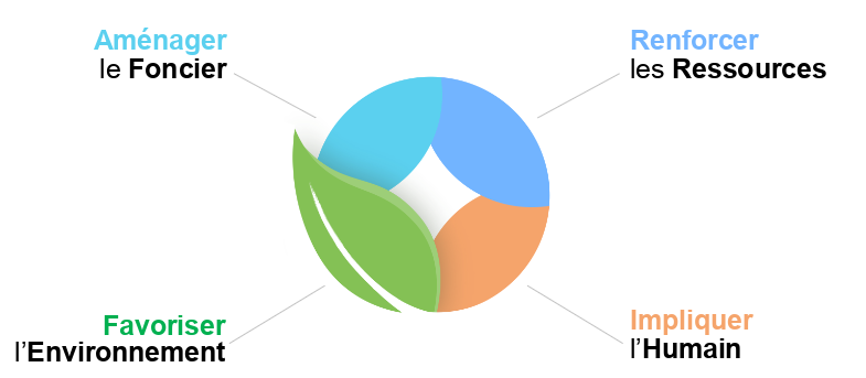
● Aide à la décision performante ● Planification éclairée ● Concertation apaisée
● Gestion durable du territoire ● Communication efficace ● Valoriser la contribution de tous
Penser et construire ensemble un territoire durable !
Permet un pilotage participatif, éthique, économique et durable du territoire et de ses géo-données, tout en adressant les défis tels que transition éco-énergétique, urbanisme circulaire et planification écologique.
Révélons et construisons le potentiel numérique des territoires !
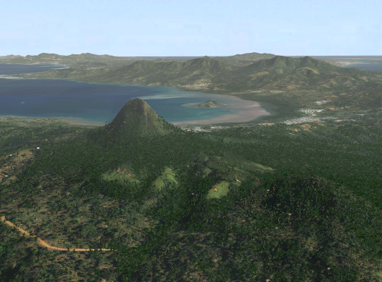
Une technologie innovante pour servir les besoins de visualisation des territoires
La visualisation interactive de paysages ou de villes nécessite des contenus 3D riches et détaillés à très grande échelle. La technologie développée par Bionatics révolutionne la modélisation et la visualisation 3D interactive de très grandes scènes. Grâce à son approche procédurale, la scène 3D n’est pas représentée sous forme de millions de polygones calculés à l’avance (approche conventionnelle) mais sous forme de données géographiques associées à des descriptions paramétriques stockées dans une base de données géospatiale 3D. Elle permet de calculer les géométries et les détails de la scène « à la volée » en fonction de la position de l’observateur et en sélectionnant la fréquence d’affichage adaptée à l’usage de 15 à 60 images par seconde !
This website uses cookies to improve your experience while you navigate through the website. Out of these, the cookies that are categorized as necessary are stored on your browser as they are essential for the working of basic functionalities of the website. We also use third-party cookies that help us analyze and understand how you use this website. These cookies will be stored in your browser only with your consent. You also have the option to opt-out of these cookies. But opting out of some of these cookies may affect your browsing experience.
Necessary cookies are absolutely essential for the website to function properly. This category only includes cookies that ensures basic functionalities and security features of the website. These cookies do not store any personal information.
Any cookies that may not be particularly necessary for the website to function and is used specifically to collect user personal data via analytics, ads, other embedded contents are termed as non-necessary cookies. It is mandatory to procure user consent prior to running these cookies on your website.